RCIS Program Overview
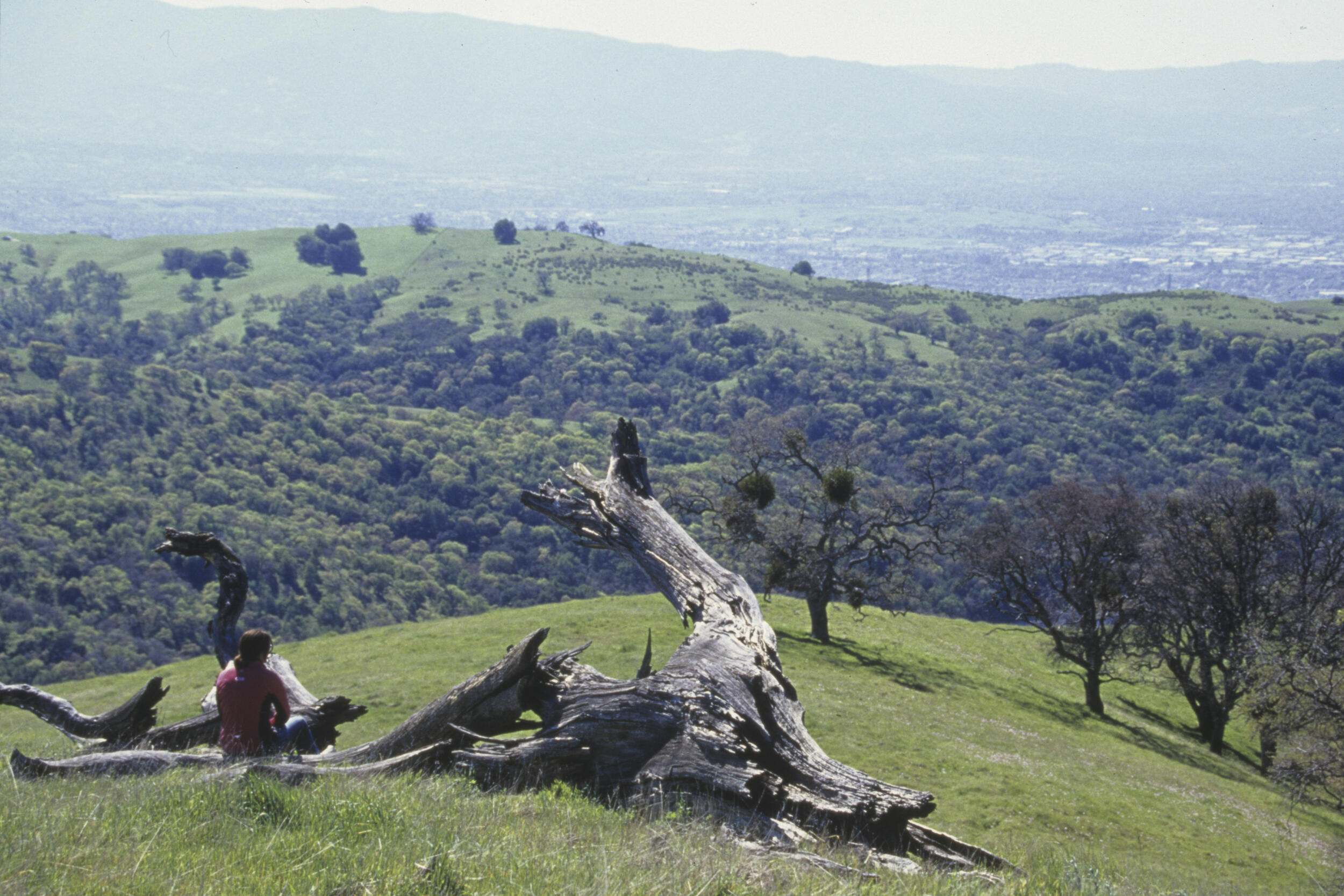
![[Input Alt Text]](https://natureconservancy-h.assetsadobe.com/is/image/content/dam/tnc/nature/en/photos/rcis/photos/ca-photos/CA_Tollhouse_Ranch.jpg?crop=0%2C146%2C2500%2C1375&wid=2600&hei=1430&scl=0.9615384615384616)
The RCIS Program helps regions create bold conservation visions for the state of California, its landscapes, and communities. RCIS Program components guide actions to conserve important lands and waters, habitats and species, inform infrastructure development, and support climate change adaptation and resilience.
The RCIS Program
Is comprised of three components:
RCA
Regional Conservation Assessment
Ecoregional ecological assessment
- The geographic scope is large -- at the eco-regional level -- providing context for the development of future, finer-scaled RCISs.
- RCA Includes:
- Regional pressures and stressors, including climate change vulnerability
- Areas of high biological diversity
- Areas for habitat connectivity
- Considers existing and foreseeable future development
- Uses best available science
RCIS
Regional Conservation Investment Strategy
Regional ecological assessment with conservation strategy (goals, objectives, and actions)
- The geographic scope is smaller than an RCA, and can be defined by sub-ecoregion, jurisdiction (one or two counties) or a watershed. Presents a finer scale comprehensive conservation strategy that identifies specific conservation actions and priorities.
- Identifies conservation strategies for species, habitats, water resources and other conservation elements with measurable goals, objectives, actions, and priorities that:
- Protect, enhance, and restore habitat
- Enhance wildlife or habitat corridors
- Contribute to regional, habitat, or species climate resilience
- RCIS includes a description of:
- Existing habitats/land cover types
- Existing protected areas
- Pressures and stressors including climate change vulnerability
- Existing and foreseeable future development
- Enables an advance mitigation pathway through the development of a mitigation credit agreement (MCA)
- Uses best available science
MCA
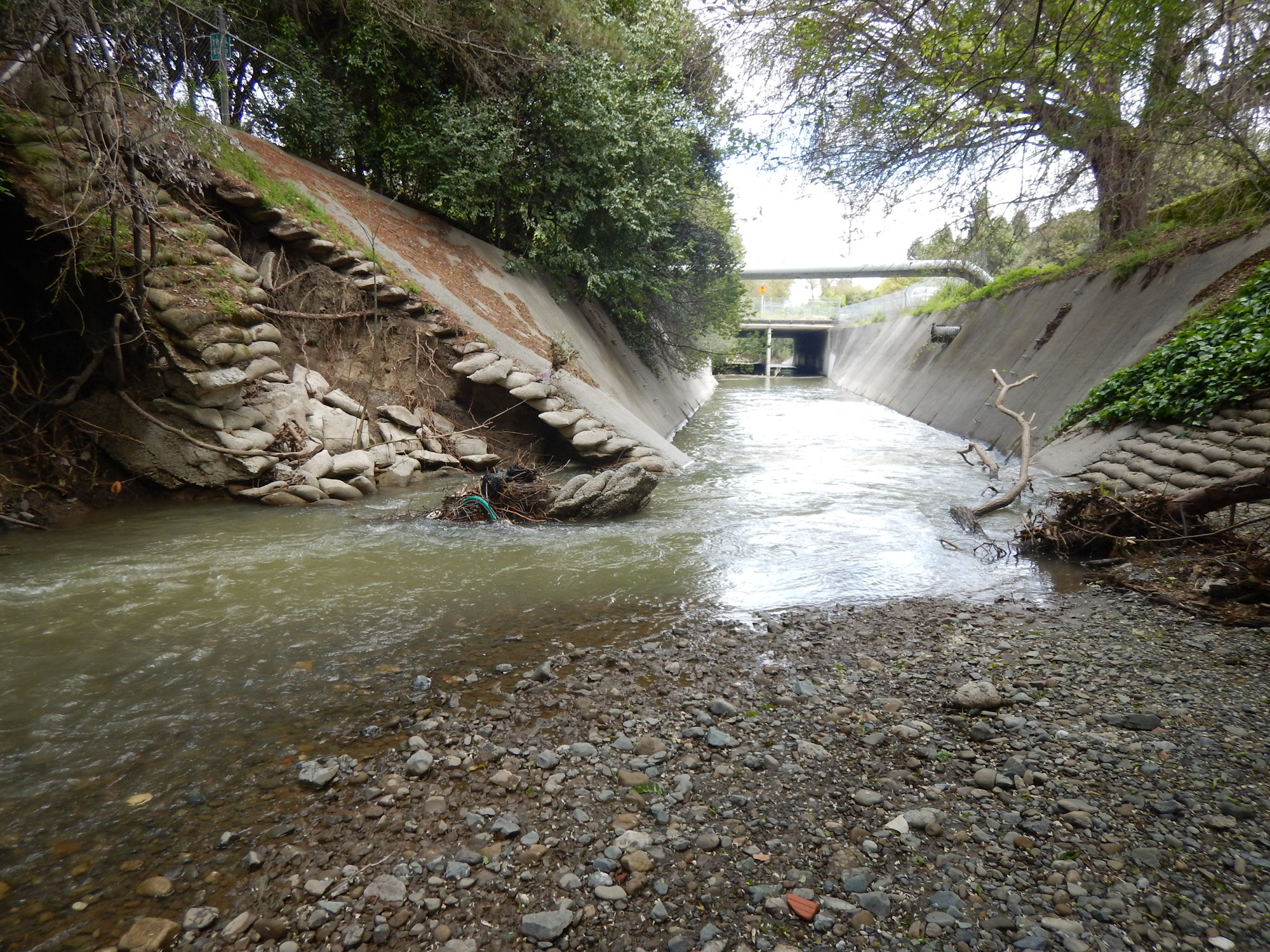
Drainage Creekbed
Mitigation Credit Agreement
Advance mitigation credits to fulfill compensatory mitigation requirements, through implemention of RCIS actions, as determined by the applicable local, state or federal agency.
- Creates a flexible advance crediting mitigation mechanism
- Must occur within approved RCIS
- Credits can be applied for both permanent or non-permanent project impacts
- Can be established on private or public lands
- Allows for compensatory mitigation for impacts to:
- Threatened and endangered species, and other sensitive species
- Natural communities and habitats
- Ecological processes
- Wildlife corridors
- MCA credits can be used to fulfill compensatory mitigation requirements identified by regulatory agencies for permits including:
- California Endangered Species Act
- California Environmental Quality Act
- California Lake and Streambed Alteration program
- Through early engagment with other agencies during the development process, MCA credits can be applied to other local, state or federal environmental laws in addition to those listed above.
RCIS Program Overview
The Regional Conservation Investment Strategy (RCIS) is a voluntary program in California that encourages landscape-level conservation planning and assessments to guide infrastructure development. The RCIS Program's goals include:
- Identifying high-value conservation and habitat enhancement opportunities
- Helping species respond and adapt to climate change
- Supporting climate adaptation and resilence
- Providing a science-based guide for conservation and mitigation actions
The RCIS program is made up of three components: Regional Conservation Assessment (RCA), Regional Conservation Investment Strategy (RCIS), and Mitigation Credit Agreement (MCA).
This voluntary, non-binding, non-regulatory planning process, enabled by Assembly Bill 2087 in 2016 (Fish & Game Code, sections 1850-1860) is administered by the California Department of Fish and Wildlife (CDFW), and is intended to encourage high quality conservation outcomes and includes an advance mitigation pathway.
The geographic region for an RCA is at the larger, ecoregion level, while the boundaries of an RCIS are regional and may be based on an ecological boundary, jurisdictional boundary, or watershed/river basin extent. An RCIS is a comprehensive conservation strategy at a more granular level that identifies specific actions and priorities to facilitate conservation outcomes.
Advance mitigation is enabled by an approved RCIS through the development of an associated MCA. MCAs create credits that can serve as compensatory mitigation to offset impacts to natural resources. MCAs implement actions identified in the RCIS such as habitat conservation or enhancements. This includes projects regulated by California Endangered Species Act (CESA), California Environmental Quality Act (CEQA), and California Lake and Streambed Alteration (LSA) program, as well as other local, state, or federal programs if acknowledged by those agencies.
A high-level description of each RCIS Program component, is also outlined in each of the tabs above, and explained in additional detail in subsequent sections.
The RCIS Program is a strategic approach to conservation planning that results in value created opportunities such as science based conservation priorities, support of grant applications, or advance mitigation credits than can be used, transferred or sold. The elements of the RCIS Program apply to different scales and needs.
This map shows how a Regional Conservation Assessment covers a larger area – for example, the nine-county Bay Area that identifies broader landscape scale ecological conditions and processes; the RCIS can tier off of an RCA to include specific conservation goals, objectives and actions at a finer scale; MCAs help implement the actions identified in an RCIS.


Connectivity and Wildlife Corridors
Addressing fragmentation- The RCIS program recognizes the need for increased habitat connectivity and provides incentives for integrating connectivity for project proponents. The Program requires connectivity to be included in RCAs and RCISs, and enables advance mitigation credits for habitat and wildlife connectivity actions in MCAs.
Learn More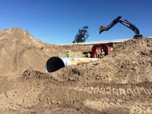


State Route 246 Retrofit: State Route 246 Culvert Retrofit – 2017 completed, between Lompoc and Buellton in Santa Barbara County, for CTS and other wildlife to cross. Will be monitored.
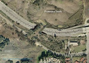
Liberty Canyon Crossing: Wallis Annenberg Wildlife Crossing, the planned 165’ wide by 200” long overpass would connect the mountain lion population and other wildlife in the Santa Monica Mountains.
Newt crossing road: Wildlife crossings © EBRPD
Summer Evening: Summer Evening // Coyote, Point Reyes National Seashore – Coyotes are often vilified, but it would be hard not to appreciate the natural beauty of this juvenile, so relaxed in my presence, casually hunting grasshoppers in the pink glow of a summer evening. © Derick Carss/TNC Photo Contest 2021
Mountain lion: Mountain lion
Understanding the Relationship Between an RCIS and MCA
Before starting along this journey, it is helpful to understand the overall picture of how inputs for the RCIS, create an RCIS strategy and those components become the input for an MCA that delivers tangible output of mitigation credits for funding conservation actions identified in the RCIS.
Completion of an RCIS is a requirement for applying for mitigation credits throught the MCA portion of the RCIS Program.
The figure below outlines how an RCIS works in terms of inputs such as goals, community input and regional plans result in a strategy delivering value in Federal and State support, as well as other funding opportunities that help deliver RCIS goals of habitat benefits, groundwater sustainability and local community opportunities.

Diagram outlining how RCIS inputs such as goals, community input and regional plans result in a strategy delivering value in Federal and State support, as well as other funding opportunities that help deliver RCIS goals of habitat benefits, groundwater sustainability and local community opportunities.
Relationship between RCIS and MCA:
An approved RCIS is a pre-requisite for applying for an MCA.
The requirements for mitigation using MCAs are closely connected to the design and information contained in the associated RCIS. By initially considering the connection to other conservation strategies, as well as the future requirements for the MCA, the RCIS proponent can more easily identify the intersection points of the voluntary RCIS strategy and regulatory requirements. This will greatly streamline the approval process and associated permitting.
The diagram below outlines key considerations for both the RCIS and MCA to maximize the benefits of both.

The requirements for mitigation using MCAs are closely connected to the design and information contained in the associated RCIS. By carefully considering the connection to other conservation strategies, as well as the future requirements for the MCA, the RCIS proponent can more easily identify the intersection points of the voluntary RCIS strategy and regulatory requirements. This will help speed along the development and approval of the MCA.
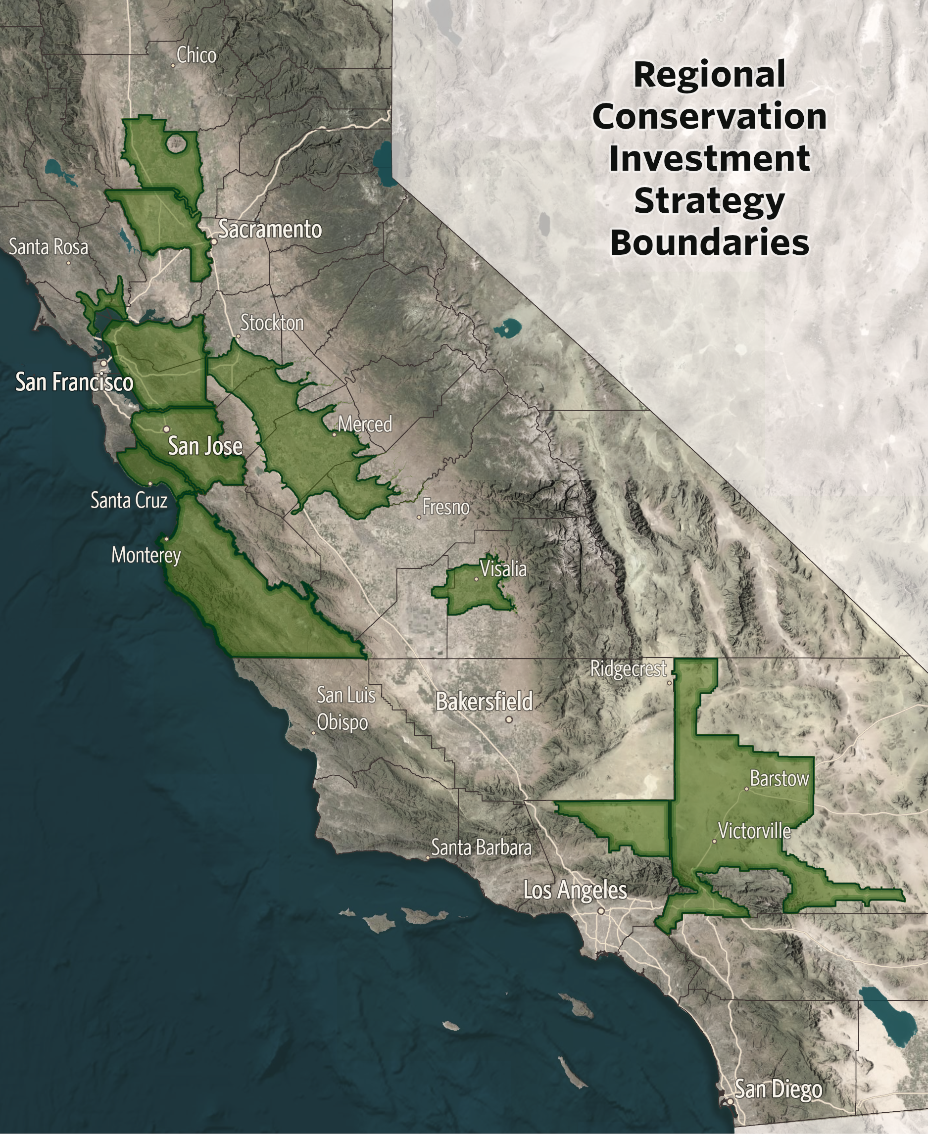
RCIS Locations (January 2025)
For an interactive map of current RCIS projects either approved or in development, please go to the CDFW RCIS Program website where you will find an interactive map. The CDFW map contains details for location and boundaries for each RCIS and is regularly updated by CDFW staff.
San Joaquin Basin RCIS
Approved
WCB grant was awarded to the Reclamation District 2092 in November 2021. The preliminary draft is in development.
A public meeting is scheduled for February 2024
The draft document is scheduled to be submitted to CDFW in March 2024