Feasibility and Scoping
Determine if an RCIS is right for you by exploring RCIS goals, scope and potential partners.


Key Questions to Explore
Goals, Scope & Partners
-
Understanding the clear use case for an RCIS, your goals or the problems you are trying to solve will help you determine if an RCIS is the right approach and adds value to your situation, objectives and others’ needs.
Goals for an RCIS can differ based on the sector or the organization’s mission. Here are examples of goals by different sectors:
- Land Trust
- Secure funding for projects and priorities (public grants, mitigation funding, private grants)
- Identify and/or align with regional conservation priorities and opportunities
- Influence land use decisions by leveraging the science
- Contribute to the land trust’s information base and strategic focus
- Create a common vision for conservation action
- Educate on values in landscape
- Partner with infrastructure agencies and others
- Infrastructure Agency
- Move projects faster through to completion, saving time and money
- More easily know how to avoid or minimize impacts to environmental resources
- Reduce the need for or amount of required compensatory mitigation
- Reduce conflicts and build support for projects by incorporating environmental values in planning process
- Enable a tool for advance mitigation
- Create a tool to mitigate for temporary impacts
- Optimize choices and trade-offs
- Work across and partner with other sectors: resource agencies, conservation organizations, local governments
- Align with existing land uses, conservation priorities, partners
- Bring more funding to a project
- Local Agency
- Bring natural resources information together in one place to help provide voluntary, flexible and non-regulatory approaches for conservation, on private and public lands
- Fill information gaps and identify priorities for local policies (General Plan Elements, Climate Action Plans)
- To create a tool for advance mitigation, including for temporary impacts
- Support local conservation plan or program
- Information and decision-support for land use decisions
- Identify land use decisions that provide for multiple-benefit outcomes.
Here are a few general questions that will facilitate dialog and help clarify the goals for an RCIS project:
- What is the problem you are trying to solve?
- What is the value in developing an RCIS?
- How would you or partners use the RCIS?
- Land Trust
-
RCIS development benefits from engaged partners, scientific and planning expertise, and clear understanding of who would use it and for what purpose. While it is critical to identify partners and entities who could be engaged or would use the RCIS in your feasibility assessment, the process of developing an RCIS will reveal other partners and entities who are interested and should be involved — expanding your reach and relevance.
- Who would an RCIS concern or affect?
- Who would support or benefit from an RCIS?
- Who would use an RCIS and for what purpose?
- Who are potential partners?
- Who do you need to talk to, to identify uses and gauge support?
-
In determining geographic location, types of boundaries (ecological vs. jurisdictional) and scale, consider your goals, potential uses, partners and resources.
- Should it be an ecological boundary? For example: watersheds, sub-ecoregions, important species and habitat ranges
- RCISs with ecological boundaries: San Joaquin Basin RCIS, North Baylands RCIS, Kaweah Groundwater Subbasin
- Should it be a jurisdictional boundary? For example: a county, part of a county or two counties, where government decisions will be critical to implementation.
- RCISs with jurisdictional boundaries: Santa Clara County RCIS, East Bay RCIS, Yolo County RCIS, Monterey County RCIS
- Should it be an ecological boundary? For example: watersheds, sub-ecoregions, important species and habitat ranges
-
The scale of the area matters for its use, resources needed and community engagement. RCISs are intended to be landscape-scale conservation strategies that cover a large enough area to include elements such as, species ranges, connectivity corridors, natural communities and ecosystem processes. Consider also, jurisdictional issues such as authorities, opportunities and barriers to implementation.
It helps to cover a large enough area that can capture planned infrastructure and development projects to enable Mitigation Credit Agreements for multiple projects. It is also important that the scale is not too large for the resources and intended goals and uses.
The scale should be appropriate to be able to support partner and community engagement, and conduct the science needed for the focal species, natural communities and other conservation elements. Examples of scales are watersheds, sub-ecoregions, one or more counties.
Resources
-
Funding is needed to develop the RCIS and all the associated activities, such as outreach, science and analysis, and communications. The RCIS proponent typically hires consultant(s) to develop the document, those with expertise in environmental planning and stakeholder engagement.
The Wildlife Conservation Board provides Prop. 68 grants to prospective RCIS proponents to develop RCISs. Typical grants have ranged between $500,000 and $800,000, with a required match from the proponents. Contact the WCB or CDFW for information, including past awards to understand the level of effort needed.
-
- Do you have support from leadership — internal and external?
- Who will be project manager, science and engagement leads?
- Who are your subject matter experts that can serve as advisors?
- What is your timeline?
- Who needs resources and for what purpose?
- Partners
- Data analysis
- Outreach and engagement
- What are the information gaps?
Is an RCIS the best approach?
-
The RCIS provides an approved framework for conservation goals, priorities and actions, from which entities can tier specific conservation and mitigation actions. Is this helpful to your goals?
-
Are you interested in advance mitigation? What mitigation demand and opportunities exist in the RCIS area?
One of the motivations for the creation of the RCIS program is the ability to enable advance mitigation at scale to help achieve project delivery and regional conservation outcomes, cheaper and faster. Infrastructure agencies and other developers that have plans for future projects that are predicted to impact sensitive species and habitats and may need to compensate for those impacts can leverage the RCIS Program to support the development of an RCIS and/or develop or partner with others on a Mitigation Credit Agreement (MCA).
An RCIS must be approved in order for an MCA to be developed and advance mitigation credits are created. If you think the area being considered for an RCIS also has potential mitigation demand and opportunities, please familiarize yourself with how the RCIS and MCA components of the RCIS program are related. There is discussion of this in the Program Overview tab.
In addition, if your project includes opportunities for habitat or wildlife connectivity, please read the section on “MCA/Connectivity” in this website.
The CDFW RCIS Program team is available to help you consider whether an RCIS and MCA are good options for your goals. Feel free to reach out directly to the CDFW RCIS program team at rcis@wildlife.ca.gov.
-
While RCISs provide an ecological snapshot of the area that includes species, habitats and natural communities (including wetlands), RCISs are approved by CDFW.
RCIS proponents are encouraged to work closely with CDFW and other agencies (such as USFWS, Army Corps, NMFS, Water Boards) throughout the development of the RCIS to ensure that the conservation framework and priorities reflect those of the agencies.
Is the fact that CDFW approves the document amenable to your goals?
-
RCISs are designed to be completed within 2-3 years from project launch and be cost effective, due to elements like using best available science and data, and no need to develop new data.
Does the timeframe meet your needs?
-
An RCIS and MCA do not, in themselves, provide permits.
Because an RCIS is an approved framework for conservation goals, priorities and actions, infrastructure or development project proponents can use an RCIS to guide project decisions, to reduce risks and costs to their projects.
In addition, MCAs provide advance mitigation credits that project proponents can use to avoid delays that may be incurred while trying to secure compensatory mitigation. That said, project proponents that need permit certainty and mitigation on a shorter timeframe (immediately - 2 years) would be more successful by engaging in an NCCP (if available) or existing mitigation or conservation banks with available credits.
-
An RCIS is one tool in the conservation planning toolbox. An RCIS is a non-regulatory and voluntary strategy that provides a science-based, collaborative conservation vision for a landscape of interest. An RCIS can demonstrate support for conservation priorities and goals for public funding and conservation projects, enable advance mitigation through MCAs, support other goals such as groundwater sustainability, climate resilience and mitigation and multi-benefit investments.
Another conservation planning tool, Natural Community Conservation Plan (NCCP), is a robust landscape-scale conservation planning and regulatory process that, once approved, advances conservation outcomes and enables appropriate development activities through streamlined permitting. Unlike an RCIS, an NCCP (and Habitat Conservation Plan) supports the issuance of permits and establishes mitigation standards or requirements, for a time period spanning decades. Developing an NCCP requires significant time and resources, as it requires a robust science effort generating new data and analysis to support the species and habitats covered, the conservation reserve design and permitting process. But once approved, the benefits to conservation and development are significant.
Development time for an RCIS is shorter, in that it is non-regulatory and a voluntary effort, leans on existing data and information, is an informational guide for conservation and infrastructure development, and enables advance mitigation credits through an MCA. An RCIS can lay the groundwork for an NCCP, assembling the existing science, developing a framework for conservation focus and outreach and engagement that a deeper effort for an NCCP/HCP can leverage, if the interest and resources allow. CDFW’s FAQ’s related to the RCIS program has a couple of points addressing RCISs and NCCPs. The CDFW FAQ’s are in the resource section of this site and highlighted here.
Another conservation planning tool is a greenprint, which is a voluntary plan, process or tool that reveals the range of benefits provided by natural infrastructure in community planning. The collaborative process brings together people and science early in the planning stage to identify the economic and social benefits of nature-based solutions. Greenprints exist at many different scales (neighborhoods to regions), representing different landscapes (urban, urbanizing, rural, agricultural), with different creators, users, motivations and drivers. Greenprints are not regulatory and can be developed by public agencies, non-profit organizations or academic institutions. Greenprints display and integrate conservation values and themes, such as habitat and species, water, agriculture, built environment, climate and equity. Greenprints do not enable permit issuance or mitigation; they are typically used for decision support, land use planning design, collaboration and education. See the Greenprint Resource Hub for more information.
A mitigation tool that requires conservation planning is an In-Lieu Fee program, an agreement between a sponsor and federal and state agencies that enables compensatory mitigation for impacts to aquatic species. A sponsor collects a fee from permittees in lieu of providing permittee-responsible compensatory mitigation required under the Army Corps or a state or local aquatic resource regulatory program. The sponsor uses the funds pooled from multiple permittees to create one or more sites to compensate for aquatic resource functions lost as a result of the permits issued. In-Lieu Fee programs develop conservation science and a mitigation framework. Once established, In-Lieu Fee programs provide streamlined mitigation for aquatic resources, but the application to species may be limited.

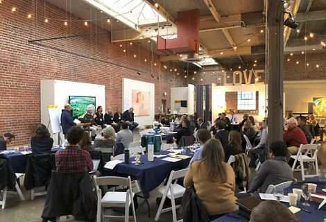
Background Information- RCIS Symposium
The Nature Conservancy, in partnership with CDFW, held a series of annual Symposium from 2018-2022 to provide information and raise awareness for the benefits of the Program. The “Resources” tab contains the presentations and Symposium summaries.